
Catchment areas of stop and stations
Providing an inviting catchment area around public transport stations is crucial because it encourages people to combine public transport with active modes like walking and cycling. Well-designed, safe, and accessible surroundings make it easier and more attractive for commuters to reach stations without relying on cars, increasing public transport usage, reducing congestion, and promoting healthier, more sustainable travel habits.
Planning of wider public transport catchment areas, (re-) design of public spaces around stations
Planning of wider public transport catchment areas involves designing the surrounding neighborhoods and routes to make stations easily accessible by walking, cycling, and other active modes. This includes identifying barriers such as busy roads, poor lighting, or lack of sidewalks and bike paths, and implementing measures to improve connectivity and safety. By expanding the functional reach of stations beyond immediate surroundings, planners can encourage more people to use public transport, reduce car dependency, and create a more integrated mobility network. Attention to factors like wayfinding, direct routes, and continuity of pedestrian and cycling networks is key to making the catchment area truly effective.
(Re-)design of public spaces around stations focuses on creating welcoming, multifunctional environments that seamlessly link public transport with active modes of travel. This can include features such as wide sidewalks, protected bike lanes, secure bike parking, drop-off zones, greenery, seating, and clear signage. Thoughtful design not only improves safety and comfort but also enhances the overall experience, making walking and cycling to stations a natural choice. Integrating urban design with transport planning ensures that stations become hubs of activity, promoting sustainable travel and supporting local communities.

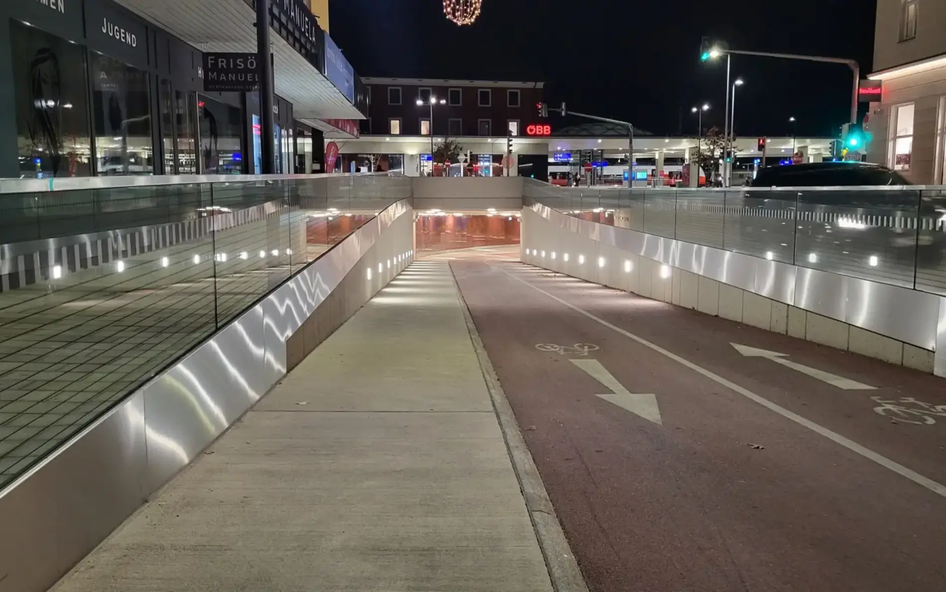
Lienz train station
Between 2019 and 2022, Lienz train station was converted into a modern mobility center for the regional center of Lienz. An important element was the pedestrian and bicycle underpass, which not only runs under the train station but also under the busy B100 road. This significantly improved the connectivity between the southern parts of the city, the train station and the center.
Learn more
General signage and orientation at public transport stations
Signage for connecting active and public transport modes is essential for guiding passengers seamlessly between walking, cycling, and public transport options. Clear and consistent signs indicating bicycle parking, bike-sharing stations, pedestrian routes, and nearby bus or tram stops help travelers plan their journeys efficiently. Well-placed directional information reduces confusion, encourages the use of non-motorized modes, and supports the integration of active travel with public transport, making the overall system more attractive and user-friendly.
Orientation for multimodal connections involves designing station environments that allow passengers to easily understand and navigate the links between different transport modes. This includes intuitive layouts, visible pathways, color-coded or symbol-based markings, and strategic placement of bike racks, drop-off zones, and pedestrian routes. Effective orientation improves safety, reduces travel time, and enhances the convenience of combining cycling or walking with public transport, promoting sustainable mobility and increasing overall ridership.

Čitelná Praha – wayfinding system
Čitelná Praha or Legible Prague is a comprehensive system of unified urban navigation for all types of mobility with a priority focus on supporting sustainable movement around the city, whether on foot, by public transport or by bike. The aim is to create an inclusive solution for all user groups, increase their information certainty and enable more movement in the public space.
Last mile solutions for walking, cycling and micro-mobility
Last-mile solutions for walking, cycling, and micro-mobility are essential for ensuring that public transport is a convenient and attractive option for more people. These solutions focus on bridging the gap between stations and final destinations through well-designed pedestrian pathways, dedicated cycling lanes, and micro-mobility options such as e-scooters or shared bikes. By providing safe, accessible, and direct routes, these measures make it easier for commuters to combine active travel with public transport, reducing reliance on private cars and enhancing overall mobility.
Integrating last-mile options with public transport systems requires careful planning of infrastructure, services, and amenities around stations. Secure bike parking, bike-sharing docks, charging stations for micro-mobility vehicles, and well-marked walking routes all support smooth transitions between modes. Coordinating schedules, creating real-time information systems, and ensuring accessibility further encourage users to complete their journeys efficiently and comfortably. Such integrated solutions not only improve travel experience but also promote sustainable, healthy, and flexible urban mobility.

Biking Reforms in São Paulo
São Paulo addressed chronic traffic, car dependence, and air pollution by expanding its bike network to 400 km, developing BRT corridors, and reforming parking regulations. With Ciclocidade’s advocacy and an ad-funded bike-sharing system, the city promoted sustainable mobility, greener transport, and livelier public spaces.
Learn more


The project Active2Public Transport is supported by the Interreg Danube Region Programme project co-funded by the European Union. The project was initiated by the Austrian Federal Ministry of Innovation, Mobility and Infrastructure (BMIMI), Department II/6 in cooperation with klimaaktiv mobil – the Austrian Federal climate protection initiative on sustainable mobility.